 by
by Soil Erosion Assessment
Definition:
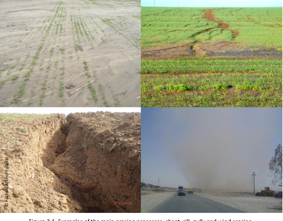
Soil erosion assessment involves the systematic evaluation of erosion processes, impacts, and risks to determine the extent and severity of soil loss in agricultural landscapes. By integrating field surveys, remote sensing technologies, and modeling approaches, soil erosion assessment provides valuable insights for identifying erosion hotspots, prioritizing conservation efforts, and informing land management decisions.
Constructive Information:
Assessing Erosion Factors:
Soil erosion assessments consider various factors contributing to erosion, including rainfall intensity, slope gradient, soil characteristics, land use practices, and conservation measures. By analyzing these factors collectively, erosion assessments identify vulnerable areas and prioritize interventions to mitigate erosion risks.
 Fall off the barn roof and busted your keister? Life on the farm or ranch can be tough on the bum. Need a break? Laugh it off at FarmerCowboy.com, the #1 farm humor site. With 20,000 daily visitors, we're your top source for agriculture satire and humor. Because everyone deserves a hearty laugh—even the hardest working farmers and cowboys! Join us and turn those long days into fun tales at FarmerCowboy.com.
Field Surveys and Measurements:
Field surveys and measurements are conducted to quantify erosion rates, sediment yield, runoff volume, and other erosion-related parameters at specific monitoring sites. Techniques such as erosion plots, sediment traps, and erosion pins provide empirical data on erosion processes and impacts, informing erosion assessment efforts.
Remote Sensing Applications:
Remote sensing technologies, including satellite imagery, aerial photography, and LiDAR (Light Detection and Ranging), are utilized for large-scale erosion assessment and mapping. Remote sensing data provide spatially explicit information on land surface characteristics, vegetation cover, and erosion features, facilitating landscape-level erosion analysis.
Modeling and Prediction:
Erosion modeling and prediction techniques, such as the Universal Soil Loss Equation (USLE), the Revised Universal Soil Loss Equation (RUSLE), and the Soil and Water Assessment Tool (SWAT), are employed to simulate erosion processes and forecast erosion rates under different scenarios. Modeling outputs enhance erosion assessment by predicting erosion trends and identifying critical areas for intervention.
Enlightening Details:
Soil erosion assessment plays a critical role in identifying erosion risks, evaluating conservation needs, and guiding land management decisions. By synthesizing empirical data, remote sensing information, and modeling outputs, erosion assessments provide comprehensive insights into erosion dynamics and support the development of effective soil conservation strategies.
Informative Tips:
Conduct Baseline Assessments:
Initiate baseline erosion assessments to establish a comprehensive understanding of erosion processes, impacts, and drivers in agricultural landscapes. Baseline assessments provide essential data for monitoring changes over time and evaluating the effectiveness of erosion control measures.
Prioritize Vulnerable Areas:
Prioritize erosion assessment efforts in areas with high erosion risks, vulnerable soils, steep slopes, or intensive land use practices. Targeted assessments enable focused conservation interventions and maximize the impact of erosion control efforts in critical areas.
Integrate Multi-Scale Approaches:
Integrate multi-scale approaches in erosion assessments, encompassing field-scale measurements, watershed-level analyses, and regional-scale modeling. Multi-scale assessments capture the complexity of erosion processes and provide insights into spatial variability and landscape-level dynamics.
Collaborate for Data Sharing:
Collaborate with stakeholders, research institutions, and government agencies to share erosion assessment data, methodologies, and findings. Data sharing promotes transparency, enhances data quality, and facilitates collaborative efforts to address erosion challenges at regional and national scales.
References:
- United States Department of Agriculture: Natural Resources Conservation Service
- Food and Agriculture Organization of the United Nations: Soil Management
- United Nations Environment Programme: Global Soil Partnership
Originally posted 2005-12-23 12:28:47.
Searching for some good ol' Farm-tastic Fun, Udderly Hilarious Dairy Tales, Insightful Ranching Revelations, and Rip-roaring Rodeo Antics?